To view Satellite Systems -
Use the Menu button and select the relevant System.

Select Sattelite Systems.

How to read the Satellite Map?
The System name appears at the top of the map. Applications are arranged by the level of integration with the system. This is based on the number of interfaces each satellite application has to the System (calculated dynamically). The top tier includes the 7 applications that have the most number of interfaces. The middle tier includes the next 14 applications, and the bottom tier the final 14 applications.
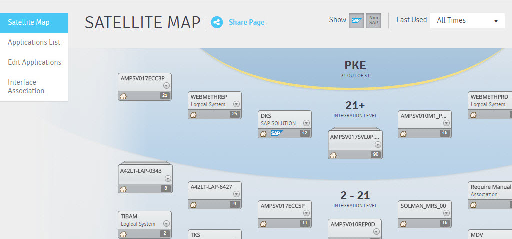
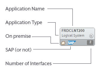
Each application box displays the application name and type, whether it is an SAP system or not, the number of interfaces, and whether it is on-premise.
If there are several grouped applications, this means that there are several applications that were identified as similar based on their interface patterns.
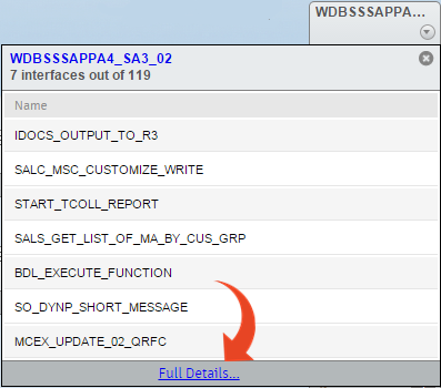
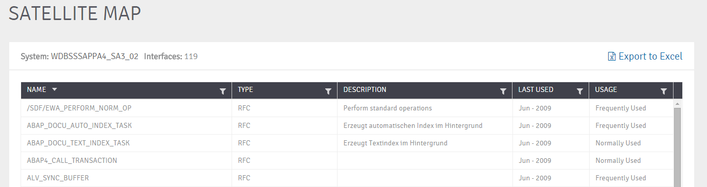
The drop-down list from within the Application window provides a preview of the top 7 interfaces. Selecting the “Full Details” link will provide the entire list. The Interfaces can be sorted and filtered according to your preferences.
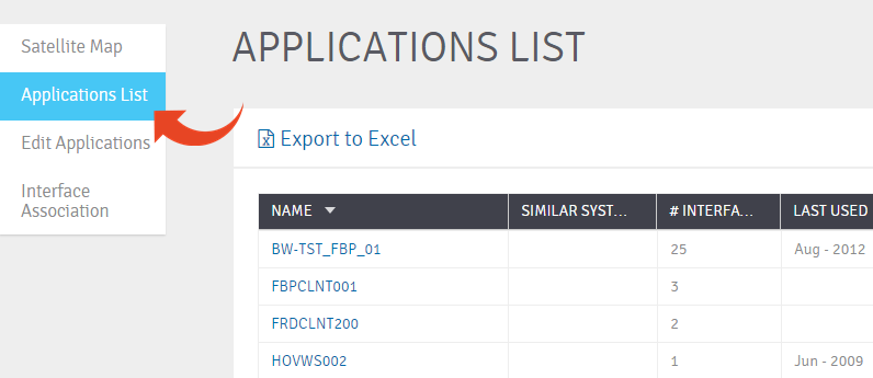
You can also view all applications in a list by selecting Applications List
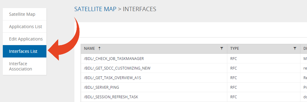
Select Interfaces List to view a company-wide interfaces list, regardless of application or system.
Select Interface Association to link any unassigned interfaces to an existing system. You can also use the New System button to create a new system and link the interface to it.